Albania is a small country with a landmass of 28,748 square km.
It is situated in the western part of the Balkan Peninsula in southeastern Europe. It shares borders with Montenegro and Kosovo to the north and northeast, Macedonia to the east and Greece to the south. To the west, Albania coast abuts the Adriatic and Ionian seas.
The Adriatic separates Albania from Italy via the Strait of Otranto (72 km). Much of Albania’s surface is mountainous – the average height above sea level is 708 m, and its highest peak, Mount Korab on the Macedonian border, is 2,753 m. Most of the population lives in the south – central lowlands and along the coastal plain.
Albanian Alps – Korab mountain
Albania lies in the subtropical belt and has a Mediterranean climate, with relatively short and mild winter and hot and dry summers. The climate of Albania varies a lot from one region to another with big contrasts in terms of temperature, rainfall, sunshine, air humidity, etc. The annual rainfall is on average 1,430mm per year, decreasing from west to east.
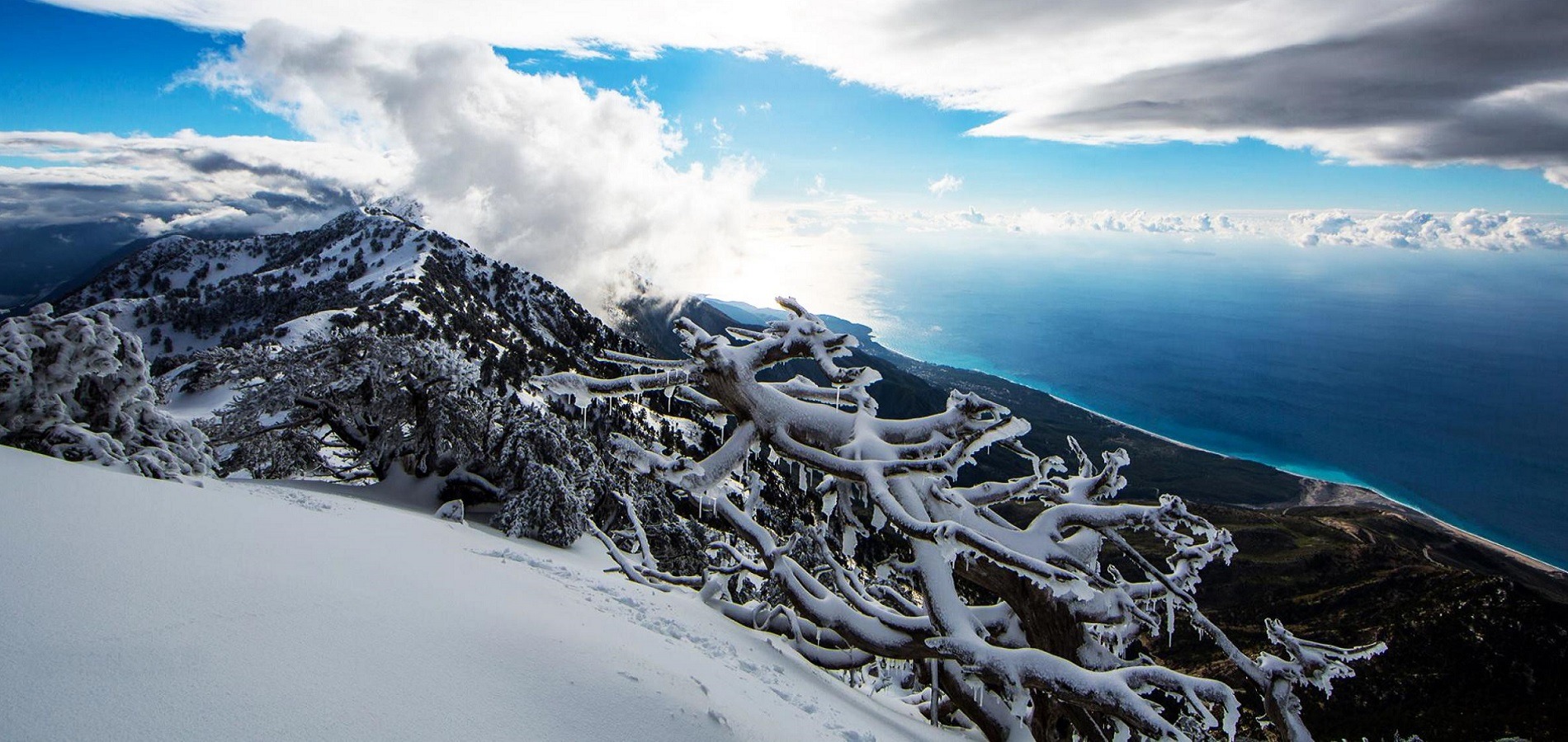
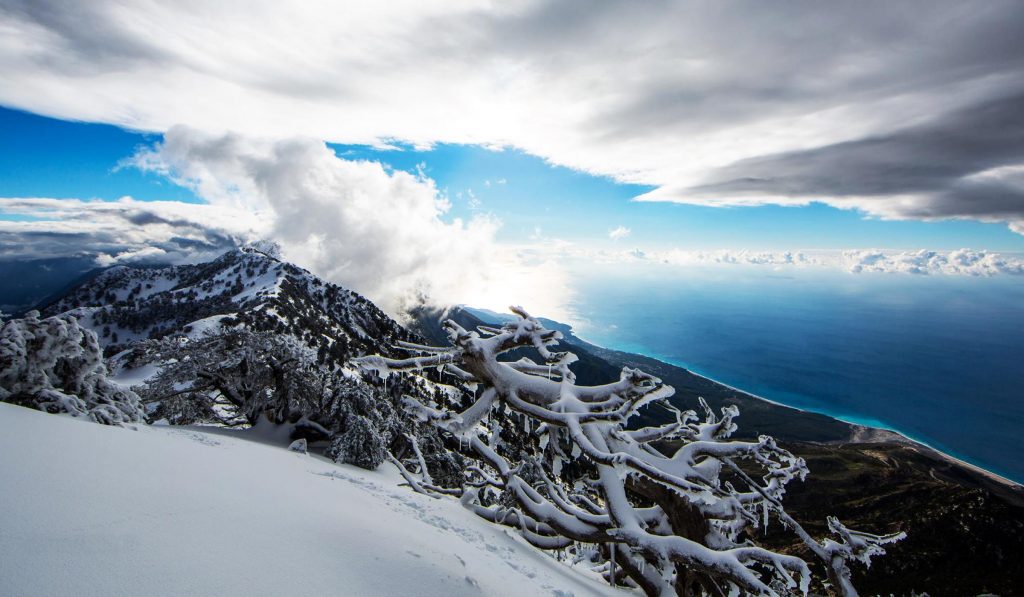 Cika Mountain, Llogara – Vlore.
The Ionian Cost is very rugged with rocky coves along the narrow coastal strip and steep mountainsides rising directly from the water for much of its length. The highest point along this stretch is at the Llogara Pass, over 1,000 m high. Geological activity and erosion have created many caves at the base of these cliffs, some of which were inhabited in prehistoric times.
The Adriatic coast is low lying, with large protected bays (such as those of Vlora and Durrës), which have been used as harbors since ancient times. The rivers that flow into the Adriatic have created fertile alluvial plains on these lowlands and, at their mouths, exceptionally rich wetlands, which are home to many waterfowl and migratory birds.
In Albania there are also a number of lakes. The most significant are:
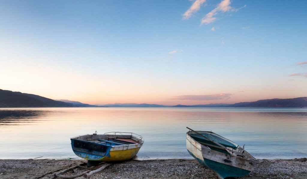
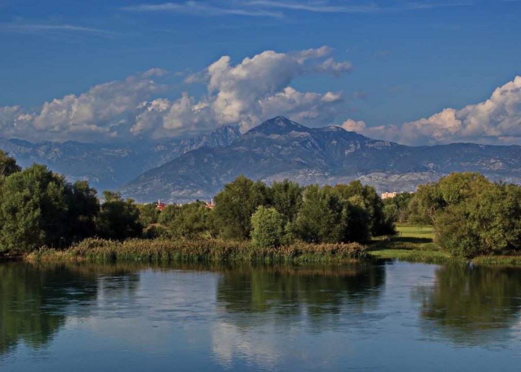 Buna river , Shkodra lake – Albania
Lake Shkodra (Skadar) is the largest lake in the Balkans and straddles the border between Albania and Montenegro. It is relatively shallow and is fed by many rivers as well as by springs, making it quite varied in aquatic life, with various species of carp and trout.
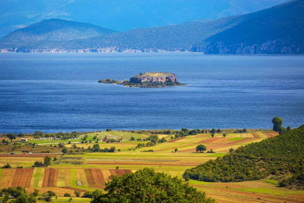
 Ohri Lake – Pogradec – Albania
Lake Ohrid is shared between Albania and Macedonia, and is found in the southeastern part of Albania. Around the shore there are a number of tourist areas such as Lin, Pojska, Pogradec, Tushemisht, and Drilon. It is exceptionally deep and fed mainly by springs around the edge of the lake and on its floor.
South of Lake Ohrid lies Prespa Lake, which is distinguished by its solitude and beautiful landscapes. In this lake one finds very important breeding populations of Dalmatian and white pelicans. Lakes Ohrid and Prespa are between two and four million years old and have uniquely evolved species of fish, among them the Ohrid trout and Belushka.
Albania is a country rich in rivers. The country has many rivers which originate in the high mountains and pass through steep gorges before reaching the plains and making their way to the sea. Most of the main rivers have been extensively managed, usually to generate electricity. Albania has nearly 450 km (280 mi) of coastline, with the Adriatic running from the Montenegrin border south to the Bay of Vlora, where the Ionian Sea begins.
The rivers create numerous valleys with spectacular views and offer opportunities for development of water sports. We should mention here the Osum canyon in Çorovodë, Gradec canyon, also along the Osum River, Këlcyra gorge on the Vjosa River, the Bënça Canyon in the Kurvelesh area, the valleys of Valbona and Shala in the Albanian Alps, the valleys of Tomorricë and the Skorana Gorge on Erzen River, etc. You will also find waterfalls with magnificent view, such as that of Grunas in Theth, in the Albanian Alps, that of Shoshan in the Valbona Valley, the waterfall of Kokotraf in Konispol, the waterfall of Progonat in Kurvelesh, etc.
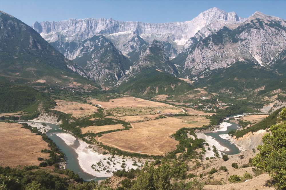 Vjosa River – Albania